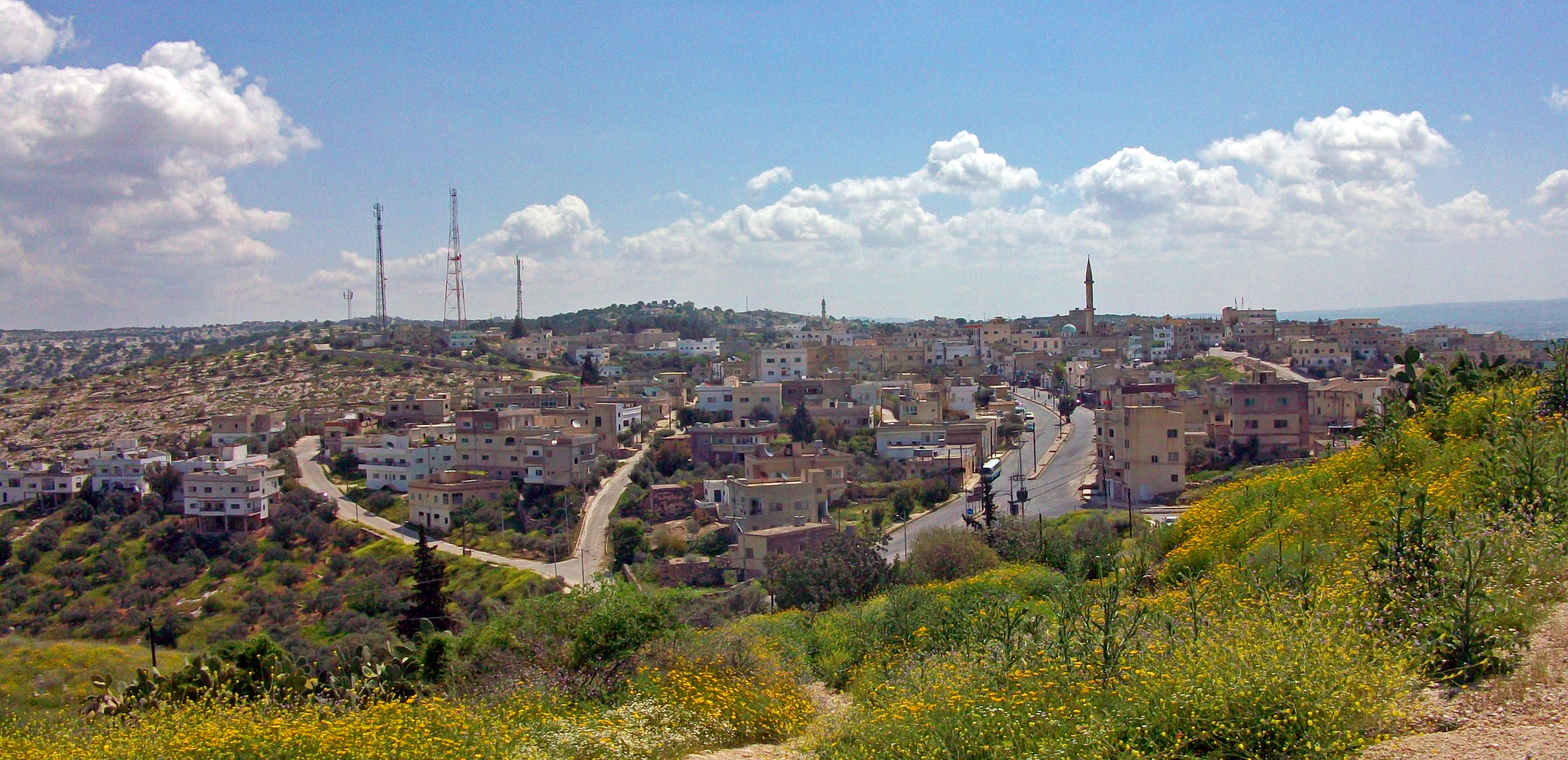
Umm Qais from the north.
Umm Qais (Arabic: أم قيس), also transliterated as Umm Qays) is a town in northern Jordan near the site of the ancient town of Gadara. It is situated in the extreme north-west of the country, where the borders of Jordan, Israel and Syria meet, perched on a hilltop (378 metres above sea level), overlooking the sea of Tiberias, the Golan heights and the Yarmuk gorge. Umm Qais is in Jordan's Irbid Governorate and belongs to the Bani Kinanah Department.
The Hellenistic-Roman town of Gadara (Hebrew: גדרה, gad´a-ra or גדר, ga-der; Greek: Γάδαρα Gádara) was also sometimes called Antiochia or Antiochia Semiramis (Ancient Greek: Ἀντιόχεια Σεμίραμις) or Seleucia.
Name

Church terrace at Umm Qais
The modern name, Umm Qais, means "Mother of Qais" in Arabic.
History of Gadara
The town is situated on a ridge, which falls gently to the east but steeply on its other three sides, so that it was always potentially of strategic importance.
By the third century BCE the town was of some cultural importance. It was the birthplace of the satirist Menippos, a slave who became a Cynic philosopher and satirised the follies of mankind in a mixture of prose and verse. His works have not survived, but were imitated by Varro and by Lucian.
The Greek historian Polybius describes Gadara as being in 218 BCE the 'strongest of all places in the region'. Nevertheless it capitulated shortly afterwards when besieged by the Seleucid king Antiochus III of Syria. The region passed in and out of the control of the Seleucid kings of Syria and the Ptolemies of Egypt.
In 167 BCE the Jews of Jerusalem rebelled against the Seleucids, and in the ensuing conflict in the region Gadara and other cities suffered severe damage.
In the early first century BCE Gadara gave birth to its most famous son, Meleager. He was one of the most admired Hellenistic Greek poets, not only for his own works but also for his anthology of other poets, which formed the basis of the large collection known as the Greek Anthology.
In 63 BCE, when the Roman general Pompey placed the region under Roman control, he rebuilt Gadara and made it one of the semi-autonomous cities of the Roman Decapolis, and a bulwark against Nabataean expansion. But in 30 BCE the Roman emperor Augustus placed it under the control of the Jewish king Herod. The historian Josephus relates that after King Herod's death in 4 BCE Gadara was made part of the Roman province of Syria.[1]
In the first century CE Jesus drove demons out of a man into swine 'in the country of the Gadarenes' (Gospel According to Matthew; the Gospels According to Mark and Luke read 'country of the Gerasenes').
Josephus relates that in 66 CE at the beginning of the Jewish revolt against the Romans the country around Gadara was laid waste,:[2]
"So Vespasian marched to the city of Gadara. He came into it and slew all the youth, the Romans having no mercy on any age whatsoever. He set fire to the city and all the villas around it."[3]
The Gadarenes captured some of the boldest of the Jews, of whom several were put to death and others imprisoned.[4] Some in the town surrendered to emperor Vespasian, who placed a garrison there.[5]
The 2nd century CE Roman aqueduct to Gadara supplied drinking water through a qanat 170 km long. Its longest underground section, running for 94 km, is the longest known tunnel from ancient times.[6]
Gadara continued to be an important town within the Eastern Roman Empire, and was long the seat of a Christian bishop.[7] With the conquest of the Arabs, following the Battle of Yarmouk in 636 it came under Muslim rule. Around 747 it was largely destroyed by an earthquake, and was abandoned.
Description

Map of the Decapolis showing location of Gadara
The ancient walls may now be traced in almost their entire circuit of 3 km. One of the Roman roads ran eastward to Ḍer‛ah; and an aqueduct has been traced to the pool of khab, about 20 miles to the north of Ḍer‛ah. The ruins include those of two theaters, a temple, a basilica and other buildings, telling of a once splendid city. A paved street, with double colonnade, ran from east to west. The ruts worn in the paved road by the chariot wheels are still to be seen.
The Gospel 'Country of the Gadarenes'
- See also: Gadreel
No town of Gadara is named in the Gospels, but a territory is described as χώρα τῶν Γαδαρηνῶν, chō̇ra tō̇n Gadarēnō̇n, “country of the Gadarenes” (Matthew 8:28). In the parallel passages (Mark 5:1; Luke 8:26, 37) is written: χώρα τῶν Γερασηνῶν, chō̇ra tō̇n Gerasēnō̇n ("country of the Gerasenes”). Ancient Greek manuscripts show variant readings (or harmonisations) in all three Gospels (Gadarenes, Gerasenes and Gergesenes), but modern textual critics agree that the original Greek text at Matthew 8 was 'chora ton Gadarenon', i.e. "the country of the Gadarenes", and the original text at Mark 5 and Luke 8 was 'chora ton Gerasenon', i.e. “the country of the Gerasenes”. In fact these two Gospel place-names probably refer to the same region. The Greek city of Gadara was considered to belong to the larger region of Gerasa, though it still retained some local autonomy (Weber 1989: 9). The jurisdiction of Gadara, as the chief town in the region, may well have extended over the country east of the Sea of Galilee, including the lands of the lesser town, Gerasa.
Neither Gadara nor Gerasa is on the shore of the Sea of Galilee. But that Gadara's territory extended to the Sea of Galilee is clearly indicated by the fact that a ship is frequently an emblem on its coins. Josephus, too, makes reference to the territory of Gadara "which lay on the frontiers of Tiberias and formed the eastern boundary of Galilee", thus placing the region of Gadara along the coast of the Sea of Galilee (Laney 1977: 134).
Exact location of the miracle


West Theatre of Umm Qais
Uncertainty exists regarding the exact site in the country of the Gadarenes or Gerasenes where Jesus healed the demoniac and sent the demons into a herd of swine which ran into the sea of Galilee. The three Synoptic Gospels indicate that it was a site where, when Jesus and his disciples stepped ashore, there met Him "out of the tombs” a man possessed by demons (Mark 5:9) whom Jesus sent into a nearby herd of "many swine feeding there on the mountain” (Luke 8:32) - swine which ran "down the steep place into the sea”; at which point those who kept them fled "and went away into the city” (Matt. 8:32-33). Thus the three Gospel accounts indicate that the location was near a port, near tombs (for the men to live in), near an area for pigs to graze, near a town (to which the men could flee), and most importantly, near a steep bank (for the herd to rush down).


Roman ruins at Umm Qais
Now, Umm Qais has high ridges and steep slopes, down which pigs could have run "violently down into the sea” (Matt 8:32). Above the port are hills which match the Biblical account. The most likely site is found at the end of a chain of hills that has a bank descending into the sea - the site of Tell es S’alib near the suburb of es-Samrah (Laney 1977: 141). A visual representation of this tell can be seen in Mendel Nun’s The Land of the Gadarenes (1989: 5). Although this tell may not have as steep a slope as that found at Kursi, it does have a hill that runs into the sea and could accommodate a “large herd of swine numbering about 2,000” (Mark 5:11). Other features of this site match the Gospel accounts. In excavations by B. De Vries in 1973 a Roman tomb from the time of Jesus was found in a valley near es-Samrah (Holm-Nielson 1992: 867): this could correspond to "the tombs" in which the Gospels' demoniac lived. Also there is a nearby site where swine would have grazed - and “the groves of oak trees on the plateau above would have provided the acorns they favored” (Walking in their Sandals: 2). Thus the site of Gadara aligns topographically with the Gospel accounts of the demoniac and the herd of swine.


View north from Umm Qais, with Sea of Galilee and Golan Heights visible.
Tourism


Beit Rousan
Many visitors come to Umm Qais on day trips from the capital, Amman, roughly 110 kilometres (68 mi) to the south, to see its extensive ruins and enjoy its panoramic views. The Sea of Galilee and Tiberias, Israel, are visible, and just across the valley of the Yarmouk River is the southern end of the Golan Heights - claimed by and recognized as Syria,[8] but under Israeli administration since the Six-Day War in 1967. Mount Hermon bordering Lebanon is visible in the distance on clear days.
At Beit Rousan - formerly the house of the Ottoman governor and now part of the complex - are exhibited Greek statues and Christian mosaics.
References
- Nun, Mendel, Gergesa (Kursi) (1989 Kibbutz Ein Gev)
- Nun, Mendel, Ports of Galilee, in Biblical Archaeology Review; 25/4: 18 (1999)
- Holm-Nielson, Svend, 'Gadarenes', in Anchor Bible Dictionary vol. 2, ed. D.N. Freedman (1992. New York: Doubleday)
- Weber, Thomas, Umm Qais – Gadara of the Decapolis (1989. Amman: Economic Press Co.)
- Laney, J. Carl, Geographical Aspects of the Life of Christ [Unpublished Th.D. dissertation, Dallas Theological Seminary ] (1977)
- This entry incorporates text from the International Standard Bible Encyclopedia with some modernisation.
Notes
- ↑ Josephus Antiquities, XVII, xi, 4; Josephus, Bellum Judaicum, II, vi, 3.
- ↑ Josephus, Bellum Judaicum, II, xviii, 1.
- ↑ Josephus, Wars of the Jews, Book 7.
- ↑ Josephus, Bellum Judaicum, 5.
- ↑ Josephus, Bellum Judaicum, IV, vii, 3.
- ↑ Mathias Döring: "Wasser für Gadara. 94 km langer Tunnel antiker Tunnel im Norden Jordaniens entdeckt", in: Querschnitt, Vol. 21 (2007), pp. 24–35
- ↑ Reland, Palestine, 776.
- ↑ For example:*UN Resolution 242, *Text of Resolution at UN.org (PDF), *"CRS Issue Brief for Congress: Israeli-United States Relations". Congressional Research Service. April 5, 2002. http://fpc.state.gov/documents/organization/9570.pdf. Retrieved 2009-06-23.,*"Presidency Statement on Golan Heights". 04/01/2004. http://www.delsyr.ec.europa.eu/en/whatsnew_new/detail.asp?id=41. Retrieved 2009-06-23.,*"Israel and the Occupied Palestinian Territories". UK Foreign and Commonwealth Office. 11 June 2009. http://www.fco.gov.uk/en/travelling-and-living-overseas/travel-advice-by-country/middle-east-north-africa/israel-occupied. Retrieved 2009-06-23.,*"The Arab Peace Initiative, 2002". Al-Bab. 2002. http://www.al-bab.com/arab/docs/league/peace02.htm. Retrieved 2009-06-23.
External links
- Jordanian Tourist Board webpage - Umm Qais
- Irbid Guide
- Greater Irbid Municipality
- Irbid news
- History and pictures
Coordinates: 32°39′N 35°41′E / 32.65°N 35.683°E
| This page uses content from the English Wikipedia. The original article was at Umm Qais. The list of authors can be seen in the page history. |