| Laconia Περιφερειακή ενότητα Λακωνίας |
|
|---|---|
| — Regional unit — | |
 |
|
 |
|
| Coordinates: 36°55′N 22°40′E / 36.917°N 22.667°ECoordinates: 36°55′N 22°40′E / 36.917°N 22.667°E | |
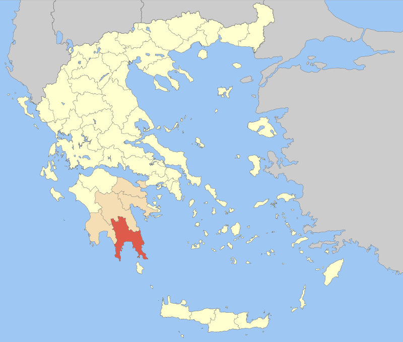
| Country | Greece |
| Region | Peloponnese |
| Capital | Sparti |
| Area | |
| - Total | 3,636 km2 (1,403.9 sq mi) |
| Population (2005) | |
| - Total | 100,871 |
| - Density | 27.7/km2 (71.9/sq mi) |
| Postal codes | 23x xx |
| Area codes | 273x0 |
| ISO 3166 code | GR-16 |
| Car plates | ΑΚ |
Laconia (Greek: Λακωνία), also known as Lacedaemonia, is one of the regional units of Greece. It is part of the region of Peloponnese. It is situated in the southeastern part of the Peloponnese peninsula. Its administrative capital is Sparti (Sparta). The word "laconic" is derived from the name of the region by analogy - to speak in a concise way, as the Spartans were reputed by the Athenians to do.
Geography[]
Laconia borders on Messenia to the west, and Arcadia to the north. Laconia is surrounded by the Myrtoan Sea to the east and the Laconian Gulf and the Mediterranean Sea to the south. It encompasses Cape Malea and Cape Tainaron and a large part of the Mani Peninsula. The islands of Kythira and Antikythera lie to the south, but they administratively belong to the regional unit of Islands. The island Elafonisos, situated between the Laconian mainland and Kythira, is part of Laconia.
The Evrotas is the longest river in the prefecture. The valley of the Evrotas is predominantly an agricultural region that contains many citrus groves, olive groves and pasture lands. It is the location of the largest coffee bean production in the Peloponnese and probably all of Greece. The brand of orange juice named after this prefecture Lakonia is based in Amykles.
The main mountain ranges are the Taygetus (2,407 m) in the west and the Parnon (1,961 m) in the northeast. Taygetus, known as Pentadaktylos (five-fingers) throughout the Middle Ages, is west of Sparta and the Evrotas valley. It is the highest mountain in Laconia and the Peloponnese, and mostly covered with pine trees. Two roads connect the adjoining prefectures of Messenia and Laconia: one is a tortuous mountain pass through Taygetus and the other bypasses the mountain via the Mani district to the south.
The stalactite cave Dirou, a major tourist attraction, is located south of Areopolis in the southwest of Laconia.
Climate[]
Laconia has a Mediterranean climate with warm winters and hot summers. Snow is rare on the coast throughout the winter, but very common in the mountains.
Template:Weather box
Municipalities of Laconia[]
The regional unit Laconia is subdivided into 5 municipalities. These are (number as in the map in the infobox):[1]
- East Mani (Anatoliki Mani, 2)
- Elafonisos (3)
- Evrotas (4)
- Monemvasia (5)
- Sparti (1)
Prefecture[]
As a part of the 2011 Kallikratis government reform, the regional unit Laconia was created out of the former prefecture Laconia (Greek: Νομός Λακωνίας). The prefecture had the same territory as the present regional unit. At the same time, the municipalities were reorganised, according to the table below.[1]
| New municipality | Old municipalities | Seat |
|---|---|---|
| East Mani (Anatoliki Mani) |
East Mani | Gytheio |
| Gytheio | ||
| Oitylo | ||
| Smynos | ||
| Elafonisos | Elafonisos | Elafonisos |
| Evrotas | Skala | Skala |
| Geronthres | ||
| Elos | ||
| Krokees | ||
| Niata | ||
| Monemvasia | Monemvasia | Molaoi |
| Asopos | ||
| Voies | ||
| Zarakas | ||
| Molaoi | ||
| Sparti | Sparti | Sparti |
| Therapnes | ||
| Karyes | ||
| Mystras | ||
| Oinountas | ||
| Pellana | ||
| Faris |
Provinces[]
- Epidavros Limira Province - Molaoi
- Gytheio Province - Gytheio
- Lacedaemonia Province - Sparti
- Oitylo Province - Areopoli
Note: Provinces no longer hold any legal status in Greece.
Population[]
- 1907: 87,106
- 1991: 95,696
- 2001: 94,918
The main cities and towns of Laconia are (ranked by 2001 census population):
- Sparti 15,828
- Gytheio 4,876
- Molaoi 3,021
- Skala 2,955
History[]
Ancient history[]
Statue of Leonidas.
In ancient Greece this was the principal region of the Spartan state. Throughout classical antiquity the Spartan sphere of influence expanded to Messenia, whose inhabitants (the helots) were permanently enslaved. Significant archaeological recovery exists at the Vaphio tomb site in Laconia. Advanced Bronze Age art is found here, and evidence of cultural associations with the co-temperaneous Minoan culture on Crete.[2] Laconia was at war with the Kingdom of Macedonia and saw several battles; at the end of the Mycenean period population of Laconia declined sharply.[3] From the early-2nd century BC until 395 it became a part of the Roman Empire.
Medieval history[]
In the medieval period it formed part of the Byzantine Empire, and following the Crusades it was the home of the Byzantine Despotate of Morea, held by the penultimate Greek ruling dynasty, the Palaiologoi. Laconia fell into the hands of the Ottomans but the Mani peninsula was mainly autonomous.
Modern history[]
Laconia was liberated after the Greek War of Independence of 1821, and after victory in battle, Sparta was selected capital of the modern prefecture; its economy and agriculture expanded. The country and the prefecture extended beyond the Laconia of ancient times, to Elafonissos in 1864, separating it from the British Empire and dissolving United States of the Ionian Islands. The island never had full Turkish rule; it was part of the Venetian Empire from the 15th century until the Napoleonic Wars. After World War II and the Greek Civil War, its population began to decline somewhat, as people moved from the villages toward the larger cities of Greece and abroad.
In 1992, a devastating fire ruined the finest olive crops in the northern part of the prefecture, and affected the area of Sellasia along with Oinountas and its surrounding areas. Firefighters, helicopters and planes battled for days to put out the horrific fire.
The Mani portion along with Gytheio became famous in Greece for filming episodes of Vendetta, broadcast on Mega Channel throughout Greece and abroad on Mega Cosmos.
Flooding ruined olive and citrus crops along the Evrotas river, as well as properties and villages there in early 2006. In the summer of 2006, a terrible fire devastated a part of the Mani Peninsula, ruining tens of its villages and crops, along with its forests.
Transport[]
- Greek National Road 39, Tripoli - Sparti - Gytheio
- Greek National Road 82, Pylos - Kalamata - Sparti
- Greek National Road 86, Gytheio - Monemvasia
- Molaoi to Leonidi Road, E, NE
Communications[]
Radio[]
- FLY FM 89,7 (Sparta).
- Lakonia FM - 91.1 FM (Sparta)
- Politeia FM - 90.7 FM & 91.5 FM
- Radio Sparti - 92.7 FM (Sparta)
- Radiofonias Notias Lakonias (Southern Laconia Radio) - 93.5 (Gytheio)
- Star FM - 94.7
Television[]
- Ellada TV - UHF 43, Sparta
- TV Notias Lakonias - Molaoi
Newspapers[]
- Λακωνικός Τύπος
- Ελεύθερη Άποψη
- Νέα Σπάρτη
- Παρατηρητής της Λακωνίας
See also[]
- List of settlements in Laconia
- List of traditional Greek place names
- Laconic phrase
References[]
- ↑ 1.0 1.1 Kallikratis reform law textPDF
- ↑ C. Michael Hogan, Knossos fieldnotes, Modern Antiquarian (2007)
- ↑ Sarah B. Pomeroy, Stanley M. Burstein and Walter Donlan (1998) Ancient Greece: A Political, Social, and Cultural History, 512 pages, Oxford University Press, ISBN 0-19-509742-4
Template:Kallikratis-Peloponnese Template:Prefectures of Greece
| This Creative Commons Licensed page uses content from Wikipedia (view authors). The text of Wikipedia is available under the license Attribution-Share Alike 3.0 Unported (ToU). |