| al-Eizariya | ||
| ||
|
[[image:Template:Location map Palestinian territories|250px|al-Eizariya is located in Template:Location map Palestinian territories]] <div style="position: absolute; z-index: 2; top: Expression error: Unrecognized punctuation character "[".%; left: Expression error: Unrecognized punctuation character "[".%; height: 0; width: 0; margin: 0; padding: 0;"> al-Eizariya |
||
| Arabic | العيزريه | |
| Name meaning | "Place of Lazarus" | |
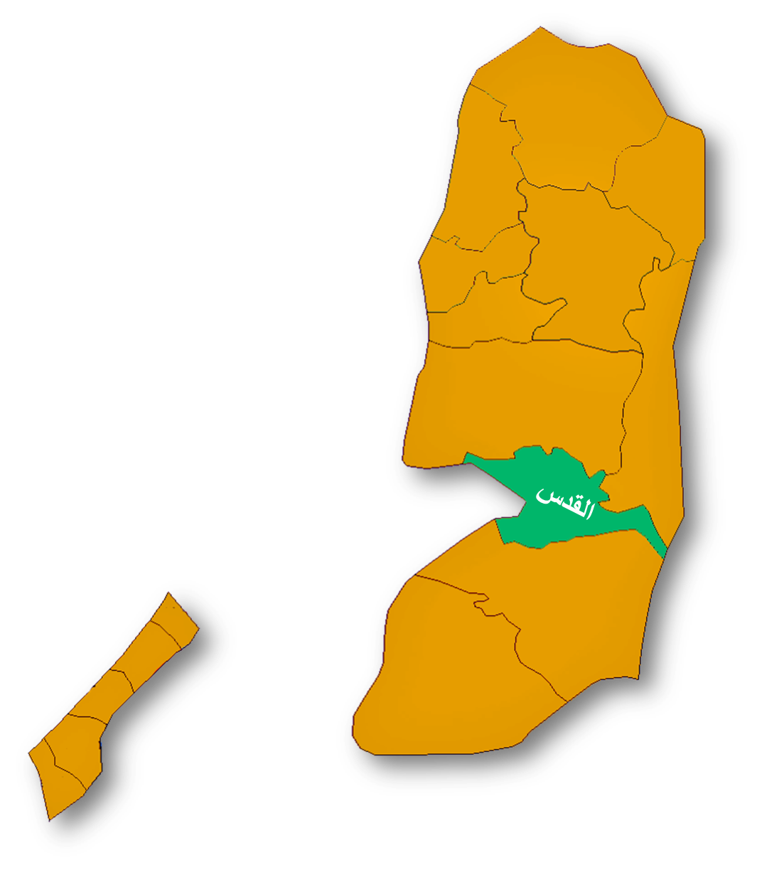
| Governorate | Jerusalem | |
| Government | Municipality | |
| Also spelled | al-'Eizariya (officially)
al-Izzariya (unofficially) | |
| Coordinates | 31°46′12.08″N 35°15′51.76″E / 31.7700222°N 35.2643778°ECoordinates: 31°46′12.08″N 35°15′51.76″E / 31.7700222°N 35.2643778°E | |
| Population | 17,606 (2007) | |
| Head of Municipality | Isam Farun | |

al-Eizariya or al-Izzariya (Arabic: العيزريه, lit. Place of Lazarus), sometimes referred to by its medieval name of Bethany, is a city in the West Bank. According to the Palestinian Central Bureau of Statistics, it is the second largest Palestinian city in the Jerusalem Governorate (not including disputed East Jerusalem), with a population of 17,606 inhabitants.[1]
Located on the southeastern slope of the Mount of Olives, less than Template:Mi to km from Jerusalem, the city is commonly identified as the site of the biblical village of Bethany. The name al-Eizariya refers to the New Testament figure Lazarus of Bethany, who according to the Gospel of John, was raised from the dead by Jesus.[2] The purported site of the miracle, the Tomb of Lazarus, in the city is a traditional pilgrimage site. The sisters of Lazarus, Mary and Martha, are also well-known biblical figures.
History[]

A postcard depicting "Bethany", c. 1900.
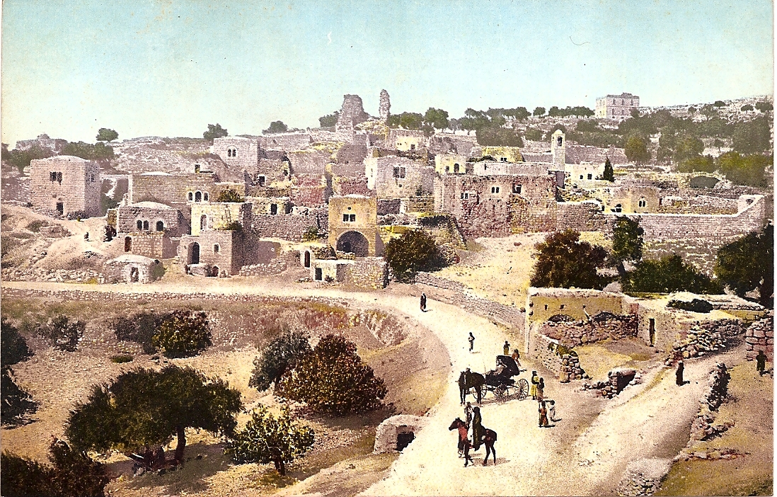

A postcard depicting "Bethany", c. 1900.
The site of al-Eizariya is believed to have been continuously inhabited from the 6th century BCE until the 14th century C.E.[3] In 1923-1924, American archaeologist William F. Albright identified the village with Ananiah (or 'Ananyab), one of the localities inhabited by the tribe of Benjamin after the return from the Babylonian Exile.[4] (Edward Robinson and others, however, identified Ananiah with present-day Beit Hanina[5]).
According to the Catholic Encyclopedia of 1913, there have been scholars who questioned whether al-Eizariya was the actual site of the ancient village of Bethany (though this was discounted by the Encyclopedia's author):
Some believe that the present village of Bethany does not occupy the site of the ancient village; but that it grew up around the traditional cave which they suppose to have been at some distance from the house of Martha and Mary in the village; Zanecchia (La Palestine d'aujourd'hui, 1899, I, 445f.) places the site of the ancient village of Bethany higher up on the southeastern slope of the Mount of Olives, not far from the accepted site of Bethphage, and near that of the Ascension. It is quite certain that the present village formed about the traditional tomb of Lazarus, which is in a cave in the village... The site of the ancient village may not precisely coincide with the present one, but there is every reason to believe that it was in this general location."[6]
The Crusaders called al-Eizariya by its biblical name Bethany. In 1138, King Fulk and Queen Melisende of Jerusalem purchased the village from the Latin Patriarch of Jerusalem in exchange for land near Hebron. The queen founded a large Benedictine convent dedicated to Sts. Mary and Martha near the Tomb of Lazarus. Melisende's sister Ioveta, thenceforward "of Bethany," was one of the first abbesses. Melisende died there in 1163; her stepdaughter Sibylla of Anjou also died there in 1165. Melisende's granddaughter Sibylla, also later Queen of Jerusalem, was raised in the abbey. After the fall of Jerusalem in 1187, the nuns of the convent went into exile. The village seems to have been abandoned thereafter, though a visitor in 1347 mentioned Greek Orthodox monks attending the tomb chapel.[7]
Since the beginning of the 16th century, almost all of the town's inhabitants have been Arab Muslims. The Ottomans built the al-Uzair Mosque to serve the town's inhabitants and named it in honor of Lazarus of Bethany (who is revered by both Christians and Muslims).[3] For 100 years after it was constructed, Christians were invited to worship in it, but the practice was frowned upon by European church authorities who preferred for adherents of the faiths to remain separate.[3]
Around 1890, Khalil Aburish, whose ancestors had officially been designated "guardians of the holy resting place of Lazarus", began promoting al-Eizariya as a tourist or pilgrimage destination.[8] In the early 20th century, visitors counted 40 family dwellings in the village.[3] In 1917, it had about 400 residents.[9]
Archeological excavations between 1949 and 1953, directed by Franciscan priest Sylvester J. Saller, revealed details of the previous Christian places of worship erected near the tomb. They also revealed evidence of the town's inhabitation during the time of Jesus.[10]
Present-day[]


Al-Eizariya and Mount of Olives from Abu Dis slope, 1940-1946.
Today, the town experiences overcrowding, due to rapid population growth and a lack of proper town planning[3] Much of the agricultural land that produced figs, almonds, olives and carob has been confiscated or cut down by Israeli authorities, or has been absorbed into the expanding built-up area of Al-Eizariya. Many of the original inhabitants now live in Jordan, the United States, and the Arab states of the Persian Gulf.[3] Real estate speculation and the opening of many bank branches briefly accompanied expectations that the Palestinian Authority would set up its seat of government in East Jerusalem.[3]
The oldest house in present-day al-Eizariya is a 2,000 year old dwelling that has attracted pilgrims who believe it might have been the House of Martha and Mary, the sisters of Lazarus.[3] There are ongoing excavations at a site just beyond the House of Martha and Mary.[3] Just west of it is the house of Simon the Leper, which is known by locals as the Tower of Lazarus and is maintained by the Greek Orthodox Church.[3]
Tomb of Lazarus and associated Christian churches[]


Purported Tomb of Lazarus in al-Eizariya (2007)


Postcard depicting "The grave of Lazarus", based on c. 1906 photograph
The Tomb of Lazarus in al-Eizariya is a traditional pilgrimage destination. The tomb is the purported site of the miracle recorded in the Gospel of John in which Jesus raises Lazarus of Bethany from the dead. The site, sacred to both Christians and Muslims, has been identified as the tomb of the gospel account since at least the 3rd century C.E. As the Catholic Encyclopedia of 1913 states, however, "It is quite certain that the present village formed about the traditional tomb of Lazarus, which is in a cave in the village. The identification of this [particular] cave as the tomb of Lazarus is merely possible; it has no strong intrinsic or extrinsic authority."[6]
Several Christian churches have existed at the site over the centuries. Since the 16th century, the site of the tomb has been occupied by the al-Uzair Mosque. The adjacent Roman Catholic Church of Saint Lazarus, built between 1952 and 1955 under the auspices of the Franciscan Order, stands upon the site of several much older ones. In 1965, a Greek Orthodox church was built just west of the tomb.
The entrance to the tomb today is via a flight of uneven rock-cut steps from the street. As it was described in 1896, there were twenty-four steps from the then-modern street level, leading to a square chamber serving as a place of prayer, from which more steps led to a lower chamber believed to be the tomb of Lazarus.[11] The same description applies today.[12][7]
People from al-Eizariya[]
- Said K. Aburish - former resident and author
Bibliography[]
- Aburish, Saïd K. (1988). Children of Bethany: the story of a Palestinian family. I.B.Tauris. ISBN 9781850431091.
- Saller, Sylvester John (1982). Excavations at Bethany (1949-1953). Franciscan Printing Press.
References[]
| Wikimedia Commons has media related to: Al-Eizariya |
- ↑ Table 9: Localities in Jerusalem Governorate by Type of Locality and Selected Indicators, 2007, Main Indicators by Locality Type - January 2009, p. 52. Palestinian Central Bureau of Statistics.
- ↑ John 11:1-53
- ↑ 3.0 3.1 3.2 3.3 3.4 3.5 3.6 3.7 3.8 3.9 Mariam Shahin (2005). Palestine: A Guide. Interlink Books. p. 332. ISBN 156656557X.
- ↑ Nehemiah 11:32
- ↑ About Beit Hanina, Official Website of the Beit Hanina Community Center; Mohamed Shaker Sifadden.
- ↑ 6.0 6.1 "Bethany". Catholic Encyclopedia. New York: Robert Appleton Company. 1913. http://www.newadvent.org/cathen/09097a.htm.
- ↑ 7.0 7.1 Bethany - Jerusalem, Sacred Destinations.
- ↑ Aburish (1988), p.10.
- ↑ Aburish (1988), p.6.
- ↑ Bethany:Introduction, by Albert Storme, Franciscan Cyberspot.
- ↑ In The Biblical World 8.5 (November 1896:40).
- ↑ Modern Bethany, by Albert Storme, Franciscan Cyberspot.
| |||||||||||||
ar:العيزرية sv:El-Azariyeh ru:Вифания